The experimental Flood Hazard Outlook (FHO) is a relatively new tool from the National Weather Service. It highlights the flash and urban flooding risks from current conditions to the next 7 days. It will work in conjunction with current products, like the Excessive Rainfall Outlook.

It was designed to portray the potential inland flash flood and river impacts that range from catastrophic, considerable, to limited impacts over a 7 day period. The tool allows users to look at a specific region and to toggle on the area of interest to read the discussion from the National Weather Service.
READ MORE: Francine forms: How and when could it impact parts of Florida?

This week, there is obvious a high interest in the Gulf coast region as #Francine approaches the United States. Flooding will be a concern (among others) as #Francine gets closer to a landfall.
Storm surge is a life-threatening hazard with , especially east of the eye, where winds may be funneled into Vermillion Bay and up to HWY 90 near Baldwin. This is the deterministic Q-risq forecast model that highlights the risk.
— Baron Weather (@BaronWeather)
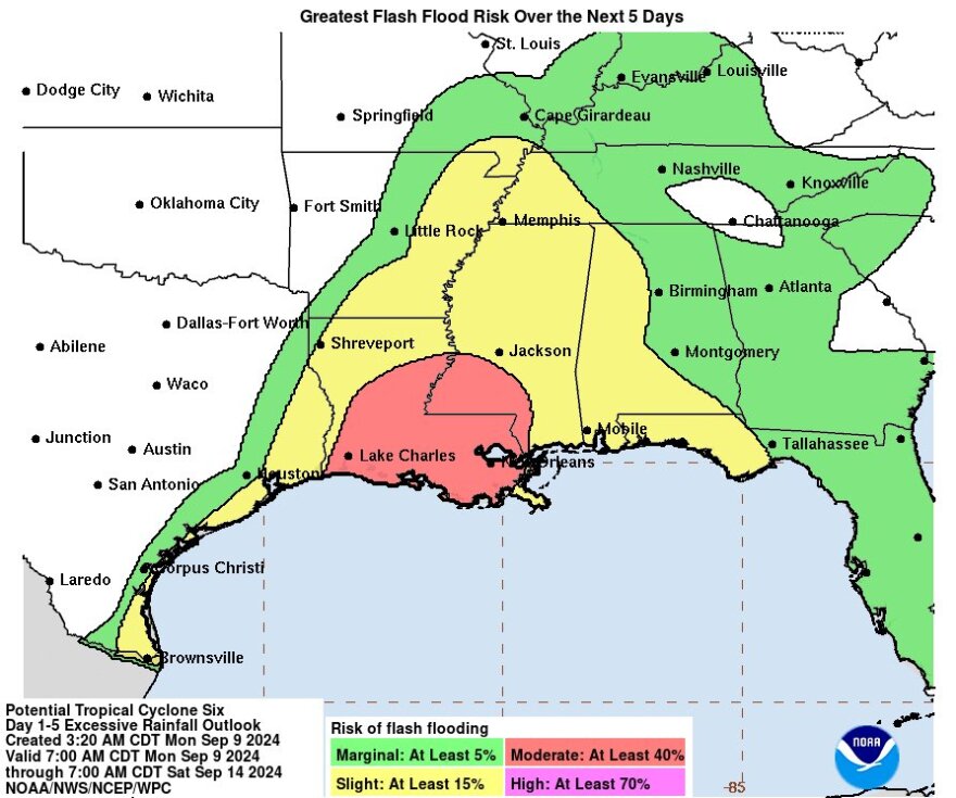
Francine is expected to pull significant tropical moisture over the Gulf coast. So local flash and urban flooding is possible, especially from Louisiana to the Florida Panhandle.
- Periods of heavy rainfall returns this week along the Texas and Louisiana coasts and further inland into Louisiana and southern Mississippi, which may result in new flooding.
- Elsewhere along the Central Gulf Coast and adjacent inland areas, flash and urban flooding remains possible through today.
- Rainfall will also return to the Mississippi and Alabama coasts and the FloridaPanhandle during the middle of next week, potentially generating isolated flooding.

The experimental Flood Hazard Outlook (FHO) was designed to provide an inland hydrologic flood graphic to help emergency manager officials, regional and National planners spread a consistent message on flood threats outlined by the National Weather Service. The experimental product combines a reflection of current flood conditions based on the latest river level observations with an assessment of flood risk.

To see the latest FWO product click the link below:
The National Weather Service issues this product twice daily, at 7AM and 4PM EST.


